The addition of image browsing at the Washington State Digital Archives has really opened up the photographic collections. So I thought I would begin a new feature of highlighting some of the great photographs of Washington's past that are available on the site. (Reminder: Though I work for the Washington State Digital Archives this blog is not a publication of that agency and I represent only myself in these posts.)
For the first post, I wanted to share this map of Spokane that I have seen nowhere else:
 (Click here to go straight to a larger version of the image at the Washington State Digital Archives site.)
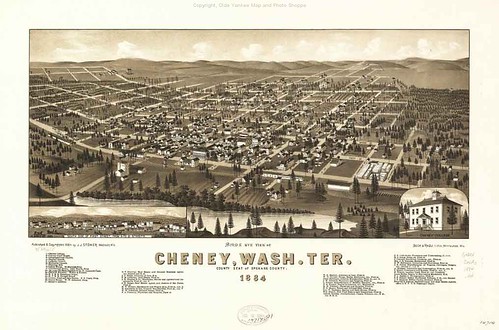
The map is captioned "Spokane Falls, W. T., 1884." Maps such as these, called "Bird's Eye" or panoramic maps, were popular in the late 19th century. Apparently a company that made them traveled through eastern Washington in 1884, as there are bird's eye maps of Cheney and Walla Walla from that year as well. The Library of Congress has a great web exhibit of its panoramic maps, along with a valuable set of essays for understanding the maps. It is important to remember that panoramic maps were created to promote development and investment and "not only showed the existing city but sometimes also depicted areas planned for development," according to an essay by John R. Hébert and Patrick E. Dempsey. So there are varying degrees of fiction and wishful thinking in these maps, and historians have to be careful using them.
The map pictured here is interesting because it pictures Spokane Falls at an early period. The city had only been incorporated three years before. And in 1889 the great fire would burn down most of the buildings rendered on the 1884 map. The city is a few blocks of brick and wood buildings, with a few more blocks of residences in each direction. The mighty Spokane River is drawn in full flood, crossed by spindly-looking bridges at Post and Howard Streets. It is a stark contrast to the better-known 1890 panoramic map of Spokane Falls, pictured below:
 Or the 1905 panoramic map of Spokane:
 ...both of which show a more developed, commercial town well past the frontier city in the 1884 map.
For the first post, I wanted to share this map of Spokane that I have seen nowhere else:
 (Click here to go straight to a larger version of the image at the Washington State Digital Archives site.)
The map is captioned "Spokane Falls, W. T., 1884." Maps such as these, called "Bird's Eye" or panoramic maps, were popular in the late 19th century. Apparently a company that made them traveled through eastern Washington in 1884, as there are bird's eye maps of Cheney and Walla Walla from that year as well. The Library of Congress has a great web exhibit of its panoramic maps, along with a valuable set of essays for understanding the maps. It is important to remember that panoramic maps were created to promote development and investment and "not only showed the existing city but sometimes also depicted areas planned for development," according to an essay by John R. Hébert and Patrick E. Dempsey. So there are varying degrees of fiction and wishful thinking in these maps, and historians have to be careful using them.
The map pictured here is interesting because it pictures Spokane Falls at an early period. The city had only been incorporated three years before. And in 1889 the great fire would burn down most of the buildings rendered on the 1884 map. The city is a few blocks of brick and wood buildings, with a few more blocks of residences in each direction. The mighty Spokane River is drawn in full flood, crossed by spindly-looking bridges at Post and Howard Streets. It is a stark contrast to the better-known 1890 panoramic map of Spokane Falls, pictured below:
 Or the 1905 panoramic map of Spokane:
 ...both of which show a more developed, commercial town well past the frontier city in the 1884 map.